Finding Pittsburgh BBQ and Motor History Along Baum Boulevard

Pork, brisket, collards and local root beer at YinzBurgh BBQ on Baum Boulevard on Pittsburgh's historic Auto Row, part of the original Lincoln Highway. (Photo by Michael Grass)

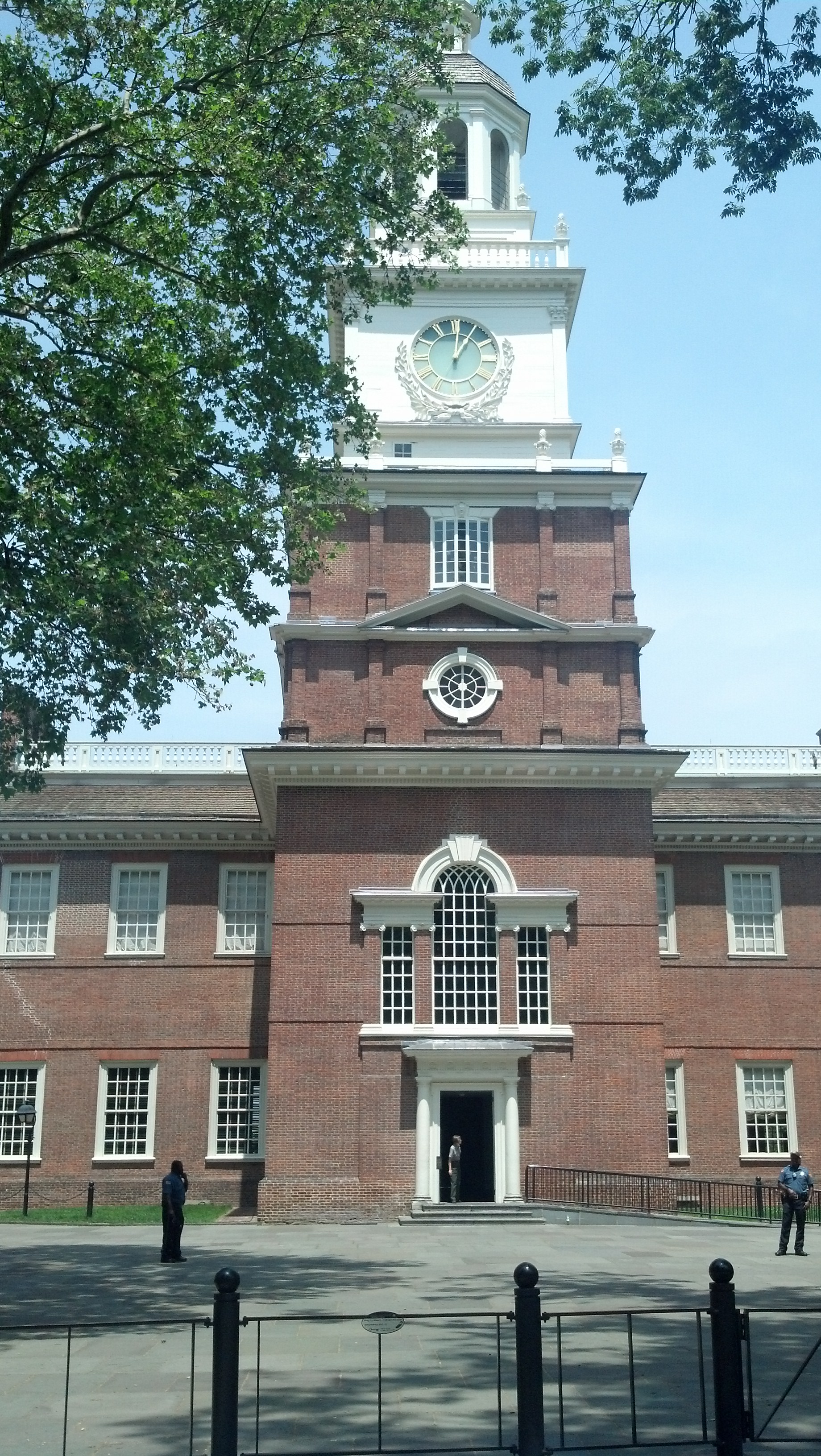
Pork, brisket, collards and local root beer at YinzBurgh BBQ on Baum Boulevard on Pittsburgh’s historic Auto Row, part of the original Lincoln Highway. (Photo by Michael Grass)

PITTSBURGH — For my Lincoln Highway journey, having Internet access via my smartphone and computer has been and will continue to be a great tool. Although I’m going across country without turn-by-turn GPS navigation — why pay for it when I have it in my brain’s spatial orientation and navigation skills for free? — I have the Internet to help me research what I want to see and where I want to go. This includes eating along the way.

When I wanted to find a good local spot for lunch on Thursday while checking out Pittsburgh’s historic Auto Row along Baum Boulevard — which is part of the Lincoln Highway’s original route — I turned to Yelp. Crowdsourcing local knowledge has been critical to the success of Yelp and similar user-generated tools.

In this case, I ended up at YinzBurgh BBQ, a 16-month-old Southern-style barbecue joint in a city not known for its barbecue.

It was a great find and something I likely would not have checked out if I was simply driving by. (I probably would have gone around the corner to Chipotle.) I spent some time chatting with YinzBurg BBQ’s owner, Richard Coursey, about my trip and his place, which offers up some great food, I might add. (YinzBurgh’s smoked meats come sauceless. Coursey’s philosophy is that sauce should be on the side and not overpower the meat itself. He has a variety of housemade sauces inspired by different barbecue traditions and he’ll be more than happy to give you a thorough introduction to YinzBurgh’s offerings.)

As I was eating some delicious barbecue and collards, I was thinking about how anyone traveling on the Lincoln Highway when it opened — or for that matter until the recent proliferation of smartphones and crowdsourcing tools like Yelp — were at a disadvantage when they drove into an unfamiliar place. Their options were limited to what was easily accessible along the road.

Continue reading

Pittsburgh Is a Paradise of Infrastructure

Pittsburgh's Point Bridge, seen here in 1900, was the first of three bridges to span the Monongahela River right before it meets the Allegheny River to form the Ohio River. (Photo by the Detroit Publishing Co. via the Library of Congress Prints and Photographs Division)

Pittsburgh’s Point Bridge, seen here around 1900, was the first of three bridges to span the Monongahela River right before it meets the Allegheny River to form the Ohio River. (Photo by the Detroit Publishing Co. via the Library of Congress Prints and Photographs Division)

PITTSBURGH — When Fort Duquesne was situated at the confluence of the Allegheny and Monongahela rivers by the French, this area was obviously strategic. It protected the gateway to the Ohio Valley and was fought over during the French and Indian War. But as cities go, the spot where modern Pittsburgh would eventually take shape wasn’t necessarily an easy place for future growth.

Most cities thrive on level ground, something that is a scarce commodity here. Constrained by its rivers and hemmed in by mountains, Pittsburgh had no such level-ground luxury.

San Francisco faced similar issues with its hilly terrain, but instead of growing organically with its setting, its street grid system brazenly defied it, creating the often steep streets that have become one of San Francisco’s signature urban elements.

While San Francisco conquered its topography with a uniform street plan, Pittsburgh conquered its difficult terrain with its infrastructure, allowing the city to expand into its higher elevations, across its rivers and other areas where the terrain would normally limit any ordinary city.

Pittsburgh functions because of its bridges. They’re everywhere.

Continue reading

On the Old Forbes Road And Over the Mountains

2013-06-05 16.06.56

This Lincoln Highway-themed gas station pump sits outside the Historic Texas Lunch in Chambersburg, Pa. (Photo by Michael E. Grass)

PITTSBURGH — It’s already abundantly clear that I’m not going to be able stop off and see — and photograph — everything that I would want to along the Lincoln Highway. That became evident yesterday as I was racing from Gettysburg to make it to the Flight 93 memorial in Somerset County before its 6:30 p.m. closing. I breezed through Breezewood, which is not that scenic, but also through places like Chambersburg, the town burned in a July 30, 1864, Confederate raid where I hopped out for literally 30 seconds to snap a photo of the highly decorated gas pump you see here.

But if this is a preview of what the highway offers as I go west, then there’ll be plenty for me to see.

The route through the mountains is naturally beautiful and largely empty, dotted with plenty of aging and artistically repurposed gas pumps, bucolic barns with Lincoln Highway murals, breathtaking mountain-top vistas of the valleys below, and plenty of 19th century buildings from the pre-Lincoln Highway days, when this was this was the primary — but rough — road across Pennsylvania.

Continue reading

The Flight 93 Memorial’s Natural Harmony and Simple Beauty

2013-06-05 18.31.52

The Flight 93 memorial near Shanksville, Pa., fits in well with the natural landscape that surrounds it. (Photo by Michael E. Grass)

SHANKSVILLE, Pa. — In the immediate aftermath of the Sept. 11, 2001, terror attacks, I remember there was some confusion as to the exact location of where United Flight 93, which was heading toward Washington, D.C., had crashed. I recall some reports that it was “near Pittsburgh.” Others played it safe with a vague description as “in Pennsylvania.” Later, the pinpointed location of the crash was said to be “near Somerset.”

It didn’t really matter at the time. Most eyes were glued to television coverage of what was happening in Lower Manhattan, so the precise location of the Flight 93 crash wasn’t of major concern, except to those to may have thought momentarily that something had happened to Pittsburgh, too.

As the geographic ambiguity remained, official statements of grief and condolence poured in from around the world. I distinctly recall a few statements reacting to the horrific tragedies in New York, Washington “and Pittsburgh.”

Eventually, the chosen reference point for the remote crash site was Shanksville, a tiny borough off the Lincoln Highway in Somerset County.

In the years following the Sept. 11, 2001, attacks while on roadtrips between Michigan and Washington, D.C., I simply sped by on the Pennsylvania Turnpike. There weren’t any turnpike exits in the immediate area of where a national Flight 93 memorial would take shape, a site previously used for surface mining.

While there still isn’t convenient turnpike access to the Flight 93 memorial, it’s only about 3 miles from the Lincoln Highway, so it made sense to visit the site since I was passing through on U.S. 30.

2013-06-05 18.25.32

Understanding the geography of the site of the Flight 93 memorial is critical to understanding the tragedy that happened here. (Photo by Michael E. Grass)

Although I had followed the debates over the design of the World Trade Center memorial and was familiar with the design of the Pentagon’s 9/11 memorial, I don’t recall ever hearing much about the Flight 93 memorial design. My bet is that most Americans had tuned out the site near Shanksville just as I had.

So I wasn’t sure what to expect at the memorial when I approached it on the long and winding access road up from the Lincoln Highway.

When I arrived at the memorial plaza, I discovered a beautifully simple and dignified site commemorating the 40 passengers and crew members who died when the plane slammed into the ground at more than 560 mph, nearly upside down and at a 40 degree angle.

Continue reading

How To Avoid Pennsylvania Turnpike Tolls At Breezewood

BREEZEWOOD, Pa. — This so-called “Town of Motelsand fast food restaurants and gas stations and semi trucks is usually a place you can’t avoid if you’re traveling between Washington, D.C., and Pittsburgh or points westward. If you’re going to or from the Pennsylvania Turnpike, you must pass through town — there’s not much of a town here to speak of — to get to or from Interstate 70 in Maryland.

This has long been an annoyance to long-distance travelers, but an economic boost to all the businesses here.

On this trip, I’m passing through Breezewood without paying any tolls thanks to sticking to the Lincoln Highway. Onward to Pittsburgh!

Thaddeus Stevens’ Ruined Iron Works at Caledonia State Park

2013-06-05 15.13.52

The ruins of Thaddeus Stevens’ Caledonia Furnace, west of Gettysburg, Pa. (Photo by Michael E. Grass)

FAYETTEVILLE, Pa. — Thaddeus Stevens, the outspoken anti-slavery congressman from Pennsylvania, isn’t necessarily that well known today among Civil War-era political figures. Tommy Lee Jones recently gave Stevens a boost in name recognition with his fantastic portrayal of the “Great Commoner” in “Lincoln.”

But Southerners absolutely loathed Stevens, who was never shy to mince words about any subject, especially slavery and the Confederacy. Stevens was so hated by the South that during the 1863 invasion of southern Pennsylvania, Confederate Gen. Jubal Early came up to this spot on the mountain west of Gettysburg to destroy the ironworks Stevens owned.

Continue reading

Abraham Lincoln in Gettysburg

A statue of Abraham Lincoln greets visitors -- and in this case a statue of a visitor to Gettysburg -- in the center of town, outside the Wills House. (Photo by Michael E. Grass)

A statue of Abraham Lincoln greets visitors — and in this case a statue of a visitor to Gettysburg — in the center of town, outside the Wills House. (Photo by Michael E. Grass)

GETTYSBURG, Pa. — All roads may lead to Rome, but in this part of Pennsylvania, all roads lead to Gettysburg, including, naturally the Lincoln Highway. Roads from Harrisburg, Carlisle, Chambersburg, Hanover and York in Pennsylvania plus Emmitsburg, Taneytown and Baltimore in Maryland converge here.

At the center of it all is Lincoln Square. It’s a charming public space (if you can ignore all the semi trucks passing through on U.S. 30). At the southeast corner of the square is a somewhat peculiar bronze statue of Abraham Lincoln. He’s lifesize in this setting and standing with a statue depicting a contemporary visitor to Gettysburg, who is dressed in a wooly sweater, slacks with sneakers and carrying a copy of the Gettysburg Address.

Continue reading

The Lincoln Highway From Philadelphia to Gettysburg

GETTYSBURG, Pa. — I’ve arrived in the place that changed the course of the Civil War. I’ll be here for a few hours checking out some Lincoln-related sites, but before that, I want to detail the portion of the Lincoln Highway I drove a few weeks ago, between York and Philadelphia.

Although I drove this section from west to east, I’ll start in Philadelphia and work my way west back towards Gettysburg.

***

Independence Hall in Philadelphia (Photo by Michael E. Grass)

Independence Hall in Philadelphia (Photo by Michael E. Grass)

When you think of Abraham Lincoln, you don’t necessarily think of Philadelphia. But Lincoln traveled here a number of times before and during his presidency and through many of the towns the Lincoln Highway passes through between the City of Brotherly Love and Gettysburg.

According to the official Lincoln Highway map from the Lincoln Highway Association, the original route from New York City takes it into Center City right down Broad Street, Philadelphia’s primary north-south thoroughfare, to City Hall, where it heads west along Market Street, the city’s primary east-west thoroughfare, before linking up with Lancaster Avenue heading out of town.

I’ll start nine blocks east of City Hall at Philadelphia’s most recognized landmark, Independence Hall, on Chestnut Street between 5th and 6th streets.

This is a place you normally associate with the Founding Fathers, the Continental Congress and the Declaration of Independence from the 1770s. But Lincoln was here, too, albeit decades later.

Continue reading

On the Road to Gettysburg

2013-06-05 10.18.28

The first glimpse of the mountains outside Frederick, Md. (Photo by Michael E. Grass)

FREDERICK, Md. — I always love driving out of the nation’s capital on roadtrips. There’s always a sense of great anticipation of a scenic drive over the mountains plus the relief of escaping the often hellish traffic conditions in the city.

For years, Interstate 270 has been the first leg of the trip (or last leg on the return trip) between D.C. and my parents’ home in East Grand Rapids, Mich., where I grew up. I’ve driven the route countless times and when I’m driving at a good pace, I can do do the trip solo in about 10 to 11 hours.

The primary route heading connecting the nation’s capital to the Midwest does not have any grand directional signs pointing the way to Chicago or even Pittsburgh or Cleveland. It’s just I-270 North to Frederick, a city of roughly 60,000 people about 45 minutes from the Capital Beltway, depending on traffic. The city and the county that surrounds it is a growing bedroom community for D.C. and Baltimore.

About 20 minutes before Frederick, the gigantic commuter route narrows to two lanes in each direction after being a huge suburban complex of express lanes and local lanes.

For this trip, I could have stuck to the official Lincoln Highway auxiliary route linking D.C. to Gettysburg — which follows the old road, today’s MD-355, to Frederick via a jog up to Mount Airy, Md., and the former National Road — but for a quicker trip, I decided to stick to the Interstate Highway System.

Plus, I wanted to stop at the scenic overlook where I am right now. It’s not necessarily a breathtaking vista — it’s scenic nonetheless — but from here you can catch your first glimpse of the Appalachian Mountains. Beyond Frederick is Catoctin Mountain and beyond that is South Mountain.

Continue reading

Lincoln Memorial in Washington, D.C.: A Good Place to Start My Trip

The Lincoln Memorial In Washington, D.C.

Daniel Chester French’s great statue of Abraham Lincoln at the Lincoln Memorial in Washington, D.C. (Photo by Michael E. Grass)

WASHINGTON — I really should be starting my Lincoln Highway adventure at Times Square in New York City, the highway’s true eastern terminus. But I live in the nation’s capital, so starting on one of the highway’s auxiliary routes is more sensible. (I’ll be detailing some of the route in New York and New Jersey after I join up with the mainline of the highway up in Pennsylvania.)

And in any regard, starting at the Lincoln Memorial makes sense. It’s an important spot.

The national monument to the Great Emancipator, sitting at the western end of the great east-west axis that includes the Washington Monument, U.S. Capitol and the National Mall, is probably the most well-known representation of Lincoln anywhere.

I’ve been to the Lincoln Memorial countless times and it’s among my favorite monuments in the nation’s capital. A lot of locals like to enjoy the monuments at night when there are fewer tourists — Richard Nixon once made a bizarre impromptu pre-dawn visit to the Lincoln Memorial in what’s called the “weirdest day” of his presidency — but I think it’s fascinating to go when it’s packed with people.

Why? Am I a glutton for punishment? No. When it’s crowded with visitors, you get to witness something that’s similar to a religious pilgrimage. The great Doric temple, designed by Henry Bacon and completed in 1922, is accessed by a grand and somewhat imposing staircase. It’s certainly not like the climb up to the Acropolis in Athens — which I did back on a sweltering summer day in 1996 during a high school Latin Club trip to Greece — but the experience is similarly humbling. You feel tiny in comparison to your surroundings, especially when you turn around to see the grand expanse of the great public space stretching beyond the Washington Monument to the east.

Continue reading