Windmill, Golden Dome Mark Lincoln Highway’s Mississippi Crossing

2013-06-12 16.57.22

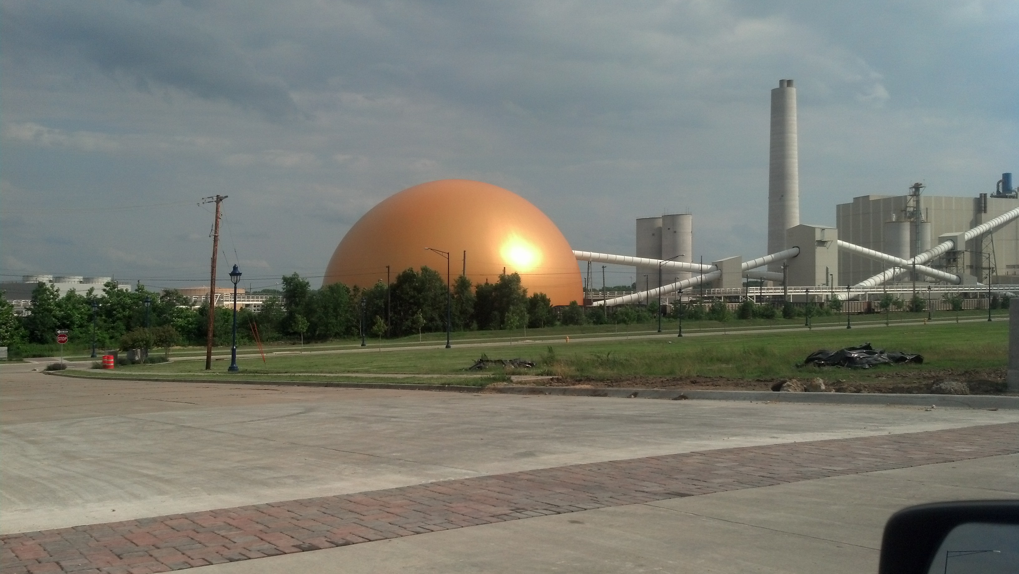
This Archer Daniels Midland coal storage facility in Clinton, Iowa, is hard to miss. (Photo by Michael E. Grass)

CLINTON, Iowa — There are two ways to cross the Mississippi River heading west on the Lincoln Highway from Illinois into Iowa. U.S. 30’s Gateway Bridge, a suspension span, provides a faster way through the area. But it skips Fulton, Ill., the town where the Lincoln Highway previously crossed on a bridge dating to 1891, later torn down and replaced.

2013-06-12 16.32.36

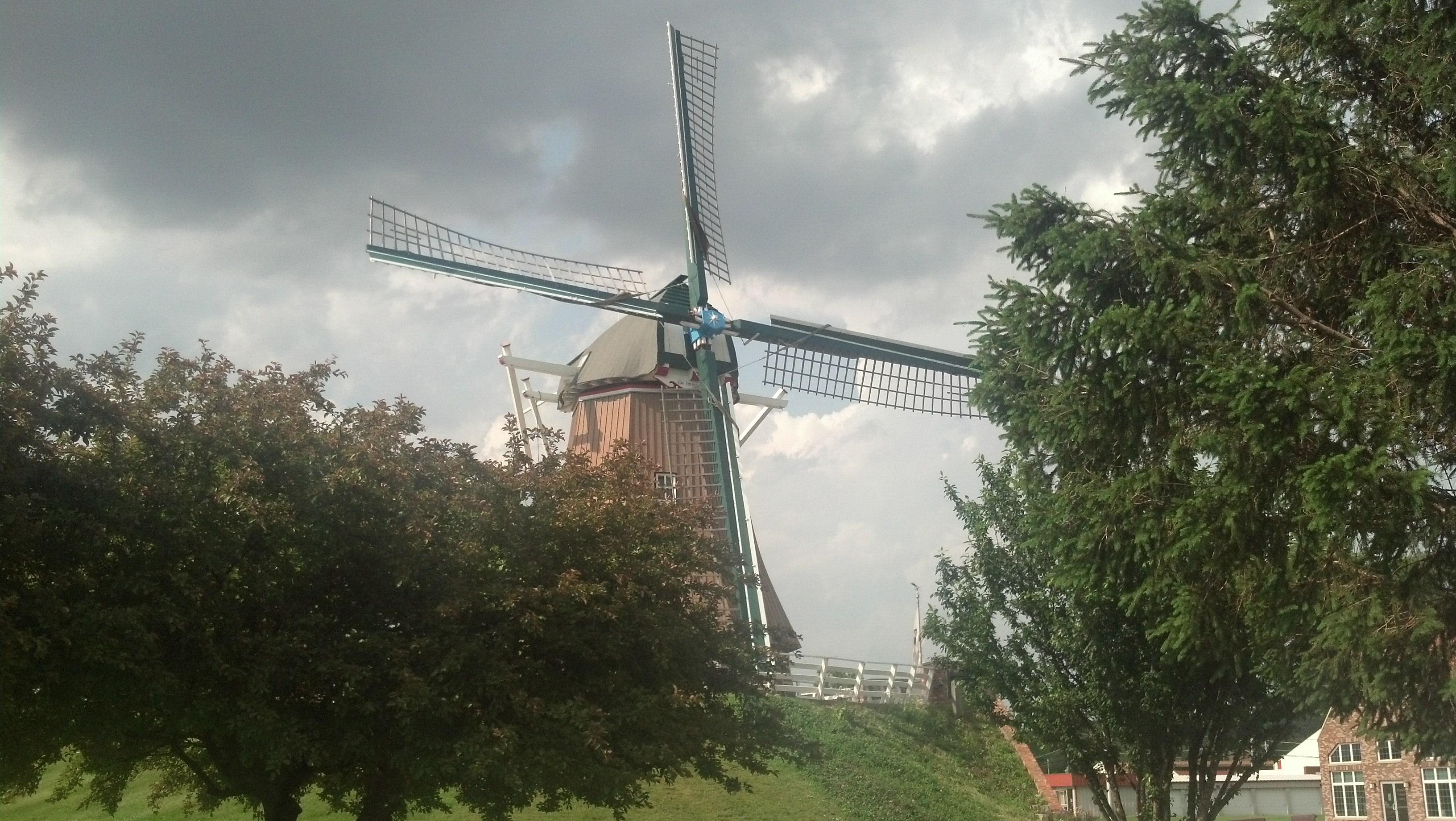
The Windmill Cultural Center in Fulton, Ill., sits adjacent to the town’s Mississippi River levee. (Photo by Michael E. Grass)

Today, there’s a giant Dutch-style windmill that sits atop Fulton’s Mississippi River levee at the foot of 10th Avenue at 1st Street, where a the Windmill Cultural Center is located. Dutch settlers originally came to this spot along the Mississippi in 1835. Many more, including members of the Dutch Reformed Church, started coming in higher numbers in the 1870s. (The city hosted its Dutch Days in May.)

Today, you can take the 1970s era Mark N. Norris Bridge to connect with U.S. 67 to head into the heart of Clinton, formerly the “Lumber Capital of the World,” and link back up with U.S. 30 to head west. (My hometown, Grand Rapids, Mich., is the “Furniture Capital of the America.”) Clinton’s Sawmill Museum is on Grant Street, along Clinton’s Mississippi River levee.

Sawmills in Clinton processed lumber that came downriver from Minnesota and Wisconsin along the Mississippi. That processed lumber was then taken by rail to Chicago and points east, or to points farther downriver. But Clinton’s lumber boom went bust in the 1890s.

Continue reading

Storm Dodging In Northern Illinois

The dark clouds behind the big arch in Dixon, Ill., would blow up into a massive storm as it moved east. (Photo by Michael E. Grass)

The dark clouds behind the big arch in Dixon, Ill., would blow up into a massive storm as it moved east. (Photo by Michael E. Grass)

STERLING, Ill. — Driving into this Northern Illinois town on Wednesday afternoon, the skies behind me were very, very dark. Had I stuck around in Dixon, the town about 13 miles to the northeast where Ronald Reagan lived as a boy and Abraham Lincoln was stationed as  militia captain during the Black Hawk War, I likely would have been pounded by intense rain, wind, hail and who knows what else.

2013-06-12 15.14.12

Ronald Reagan Peace and Freedom Park in Dixon, Ill. (Photo by Michael E. Grass)

Thanks to my Weather Channel smartphone app, I knew there was a small but intense storm cell about 10 miles outside Dixon. My current location was in the prediction path’s cone. I could tell from the foreboding skies to the southwest that it wasn’t a benign storm.

After quickly checking out Lee County Courthouse grounds, the Ronald Reagan Wings of Peace and Freedom Park and Dixon’s famous Veterans Memorial Arch over Galena Avenue, I got back on the road to continue on my way.

Abraham Lincoln spoke in Sterling, Ill., in 1856. (Photo by Michael E. Grass)

Abraham Lincoln spoke in Sterling, Ill., in 1856. (Photo by Michael E. Grass)

Fortunately, the path of the Lincoln Highway along the Rock River between Dixon and Sterling kept me just to the north of the storm. But I could see the rain in the distance. I could feel the wind on the car.

Right after I checked out the Lincoln statue in Sterling’s Propheter Park, which marks the spot where Lincoln delivered a speech in 1856 to support the presidential candidacy of Republican John C. Frémont, a tornado warning was issued by the National Weather Service.

Continue reading

Racing Through Chicagoland’s Sprawling Southern Extremities

JOLIET, Ill. — Driving west along the Lincoln Highway out of Indiana, U.S. 30 cuts through the southern extremities of Chicagoland. For a time, it follows part of the old Sauk Trail, the great path between the Mississippi River and the Detroit River developed by generations of Native Americans and improved by early European settlers.

U.S. 30 through the southern part of the Chicago metro area is under reconstruction. (Photo by Michael E. Grass)

U.S. 30 through the southern part of the Chicago metro area is under reconstruction. (Photo by Michael E. Grass)

The city of Chicago itself is more than 30 miles to the north but if you’re familiar with the Windy City’s major north-south thoroughfares, they’re down this way, too. Cottage Grove Avenue, State Street, Halsted Street, Ashland Avenue, Western Avenue, Pulaski Road, Cicero Avenue and Harlem Avenue disappear into the exurbs and farmland miles to the south of the Lincoln Highway.

After passing through gritty Chicago Heights, where there are scores of vacant lots and abandoned houses along the Lincoln Highway, U.S. 30 runs through mostly suburban areas on its way to Joliet, including Matteson, Frankfort, Mokena and New Lenox.

Besides the strip malls and big-box stores, there’s not much to see here. I was in somewhat of a hurry to pass through Chicagoland on my way to Iowa. Weather forecasts for Wednesday predicted big storms to develop during the late afternoon, so I had an ever-diminishing window of time to make my way through.

As I drove along U.S. 30 toward Joliet, the highway was under major reconstruction, but it didn’t slow me down too much.

Joliet is known for a few things.

Continue reading