Pressing Fast Forward for Just a Moment

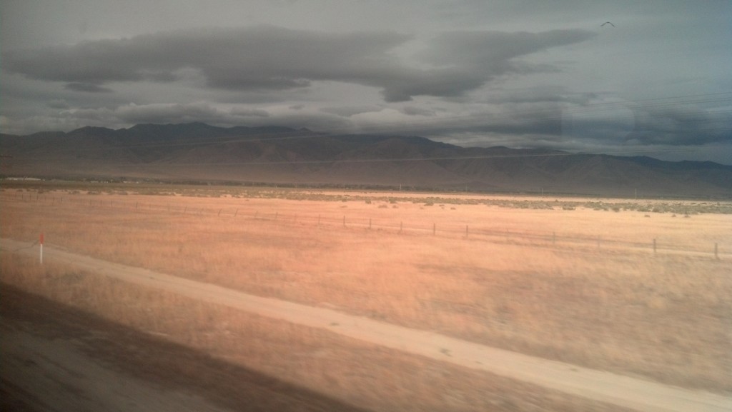
Racing toward dusk through northern Nevada on Amtrak's California Zephyr (Photo by Michael E. Grass)

Racing toward dusk through northern Nevada on Amtrak’s California Zephyr (Photo by Michael E. Grass)

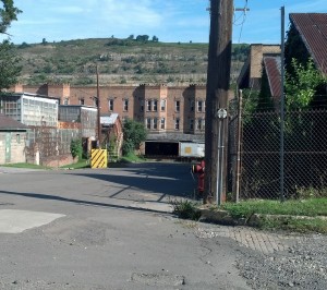
Newell, W.Va. (Photo by Michael E. Grass)

Newell, W.Va. (Photo by Michael E. Grass)

WASHINGTON — When I set out on my Lincoln Highway adventure in early June, my goal was to write a travelogue in real time or as close to real time as possible. Well, for those who have been following my dispatches on this blog or via social media, you know that my good intentions to do that ran into the realities of having to drive long distances, exhaustion, limited Internet access at times and other factors that slowed me down. Then a backlog of posts started to build. Then the reality of normal life back in D.C. came into play. You get the idea …

Although I’ve been slowly digging out of the backlog and I have now posted a dispatch featuring the last leg of my westward trip on the Lincoln Highway to San Francisco, I’m not done with the Lincoln Highway Guide just yet. There’s still more writing from my adventures I’m sorting through. I have plenty of notes to make sense of.

Since leaving San Francisco on June 24, I’ve actually continued traveling along portions of the highway and I expect that I will continue to, albeit gradually, write about the various places along the way, though it probably won’t be in sequential order.

So here’s a preview of where I’ve been and what I’ve done since finishing the main part of my Lincoln Highway adventures:

  • I took Amtrak’s California Zephyr from Emeryville, Calif., to Denver, and later from Denver to Chicago. Its route follows, in part, the route of the first transcontinental railroad, a rail link championed by Lincoln while in office and completed four years after his assassination.
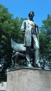
  • Augustus Saint-Gaudens' statue of Abraham Lincoln in Chicago's Lincoln Park (Photo by Michael E. Grass)

    Augustus Saint-Gaudens’ statue of Abraham Lincoln in Chicago’s Lincoln Park (Photo by Michael E. Grass)

  • In Chicago, which sits on an auxiliary route of the Lincoln Highway, I visited various Frank Lloyd Wright sites, including the playroom where the inventor of Lincoln Logs spent much of his childhood. I also visited Lincoln Park and Augustus Saint-Gaudens’ statue of Abraham Lincoln.
  • In Washington, D.C., I’ve revisited some Lincoln-related sites, including the Lincoln Gallery in the Smithsonian American Art Museum, where Lincoln’s second Inaugural Ball was held on March 6, 1865.
  • I’ve driven the bulk of the Lincoln Highway in western Pennsylvania two more times (including a lazy afternoon at historic Ligonier Beach) and the majority of the highway in Ohio a second time, including a stop at the Hungarian pastry shop in Wooster (which may be my new favorite place for food in the Buckeye State).
  • I’ve driven the majority of the Lincoln Highway in New Jersey, including stops in Princeton and Newark for Portuguese food.
  • I’ve visited a few sites related to Horace Greeley in New York City. The sites aren’t directly tied to the Lincoln Highway, but to understand the life and times of Abraham Lincoln, you must understand the life and times of Horace Greeley.
So, please check back for more updates of my adventures.

Not Quite the End of My Trip

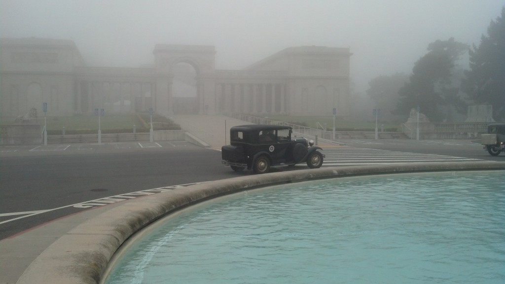
One of the last cars in the Lincoln Highway Association's auto tour departing the Palace of the Legion of Honor in San Francisco bound for the Lincoln Highway's 100th anniversary celebrations in Kearney, Neb. (Photo by Michael E. Grass)

One of the last cars in the Lincoln Highway Association’s auto tour departing the Palace of the Legion of Honor in San Francisco bound for the Lincoln Highway’s 100th anniversary celebrations in Kearney, Neb., on June 23, 2013. (Photo by Michael E. Grass)

SAN FRANCISCO — When I set out on my trip along the Lincoln Highway from the East Coast to California, my goal was to make it to the California Palace of the Legion of Honor by the time the Lincoln Highway Association‘s western auto tour was going to depart for the highway’s 100th anniversary celebrations in Kearney, Neb.

Just as I was wrapping up my transcontinental journey, I wanted to see these Lincoln Highway enthusiasts off. It was early on this Sunday morning in mid to late June and San Francisco was shrouded in fog, as it apt to happen.

To reach the end point of the Lincoln Highway at the Pacific Ocean — my ultimate destination for this trip — I decided to drive along the Embarcadero from the Bay Bridge up toward the Marina District, cut south and eventually make my out through the Inner Richmond District via California Street to the Palace of the Legion of Honor, which sits within Lincoln Park, where the highway terminates.

Although I had been in San Francisco one time before for a work trip more than a decade ago, this was my first time as a driver in the city itself. But in any regard, San Francisco is built mostly on a grid — in my youth, I loved studying my fold-out map of San Francisco — so, how hard could it be?

Well, to make a long story somewhat shorter, I got caught up in the hills of Pacific Heights, on the edge of the Presidio, where the street grid is interrupted, and I had to doubleback to Divisadero Street.

This slower route, plus countless four-way stops, ended up costing me 15 to 20 minutes longer than I had anticipated. So just as I was driving up El Camino Del Mar from Sea Cliff, I saw a couple of vintage automobiles with Lincoln Highway Association placards driving away from the Palace of the Legion of Honor. Had I missed the departure of the auto tour?

I parked just down the hill from the plaza outside the large French neoclassical building, a memorial to soldiers who died during World War I which is part of the Fine Arts Museums of San Francisco and was modeled after the original Palace of the Legion of Honor in Paris.

Hitchcock fans will recognize this building as the art gallery where Scottie (Jimmy Stewart) followed Madeleine (Kim Novak) to the mysterious portrait of Carlotta Valdes.

As I stepped out of the car, I could feel the strong breeze from the Pacific. I could hear the ocean break on the rocks. But I couldn’t actually see the ocean in the sea of grey that surrounded me. It was OK, since I had already seen the Pacific earlier this winter at Waikiki, Kailua or the North Shore on Oahu.

Not being able to establish visual contact with the ocean, but being able to still know it was there, actually made this moment for more interesting, moody and mysterious.

Post continues below …

2013-06-23 08.09.56

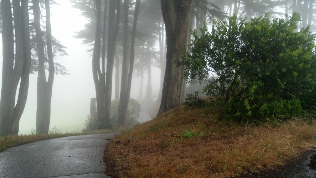
From this point, I could hear the Pacific, which was somewhere beyond the golf course below. (Photo by Michael E. Grass)

2013-06-23 07.57.38

Off into the fog. (Photo by Michael E. Grass)

By the time I walked up to the Palace of the Legion of Honor’s plaza where the auto caravan had gathered, there were only a few cars left. And those final holdouts soon departed into the fog for their long journey east to the middle of the continent. So I had essentially missed them, but made it just in time to snap a few quick photos of a few cars disappearing into the fog.

I was momentarily let down that I had more or less missed the Lincoln Highway Association auto caravan, but then something suddenly clicked.

I had made it to the Pacific! At long last, after driving thousands of miles, across the mountains, plains, forests and deserts, I realized I had accomplished my mission to drive the Lincoln Highway across the continent.

Now, I just had to make my way back east.

Continue reading

Staring Down Disaster in California

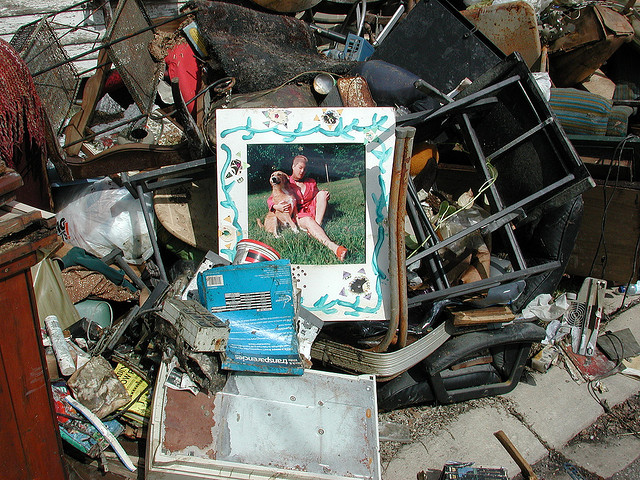
Damage from Hurricane Katrina in New Orleans. (Photo by Flickr user EditorB via CC BY 2.0 >>)

Damage from Hurricane Katrina in New Orleans. (Photo by Flickr user EditorB via CC BY 2.0 >>)

BERKELEY, Calif. — Back in 2005, a friend of mine was contemplating a trip to New Orleans.

“You should go to New Orleans before a huge hurricane destroys the city,” I said.

I had been recently reading about the nightmare Hurricane Pam scenario that disaster planners had been predicting for the city.

My friend ended up going to the Big Easy and had a good time. But later that year, Hurricane Katrina brought its destruction to New Orleans, bringing a terrible level of devastation and disruption and depopulation few major American cities have ever had to face.

When I eventually make it to New Orleans — who knows, maybe later this year? — I know I will never experience what made the pre-Katrina city such a special place.

Great cities change and evolve of course. They rebuild after great disasters like hurricanes, earthquakes and fires. Usually, they triumph over their struggle and emerge stronger, better places. San Francisco, my final Lincoln Highway destination, awaiting me across the bay from Berkeley, is a testament to that.

Post continues below …

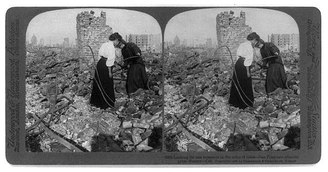
Two woman search the ruins of San Francisco in the aftermath of the 1906 earthquake and fire. (Photo via Library of Congress Prints and Photographs Division >>)

Two woman search the ruins of San Francisco in the aftermath of the 1906 earthquake and fire. (Photo via Library of Congress Prints and Photographs Division >>)

New Orleans, of course, is more precarious. It’s living on borrowed time. Rising sea levels, sinking land and stronger storms are likely to swamp the city again someday, no matter how high levees can be made.

Heading into the Bay Area, on the final leg of my crosscountry Lincoln Highway trek, disaster has been on my mind. I blame this in part to my first job out of college, working as a consultant for a Federal Transit Administration disaster and emergency preparedness program that aimed to help local transit agencies coordinate with federal, state and local government and first responders before disaster struck. (My last trip to the Bay Area was during a work trip for the FTA in 2002.)

Natural disasters and California are closely intertwined, as residents of the Golden State know well.

Continue reading

The Best Beach So Far This Year?

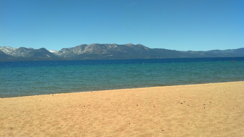
The view of California from Nevada Beach in Zephyr Cove, Nev. (Photo by Michael E. Grass)

The view of California from Nevada Beach in Zephyr Cove, Nev. (Photo by Michael E. Grass)

ZEPHYR COVE, Nev. — I’ve been truly lucky to have visited some wonderful beaches so far this year. The standouts have been Kailua on Oahu’s Windward coast and a private stretch of sand I had mostly to myself near Mahogany Bay on Barbados this past winter.

While my ultimate destination for my Lincoln Highway trip has been San Francisco, I feel like this beautiful view has been my reward for my long journey across the United States. This beautiful spot is Nevada Beach on Lake Tahoe. I’m in the middle of the Sierra Nevadas. Across the lake is the great state of California.

Nevada Beach, near the Nevada-California state line on the southern end of Lake Tahoe. (Photo by Michael E. Grass)

Nevada Beach, near the Nevada-California state line on the southern end of Lake Tahoe. (Photo by Michael E. Grass)

After crossing the great expanses of the Great Basin and the Great Plains, it’s nice to see a sizable body of water that’s not salty. Earlier on this trip, I listened to this National Public Radio report featuring a group of crazy swimmers who battle brine flies and endure pickled tongues while swimming in the Great Salt Lake.

A lake that’s saltier than the ocean with water that’s corrosive to bare skin is not appealing to swim in. I breezed right by the Great Salt Lake a few days earlier.

Lake Tahoe is a different matter. I happily went for a swim here.

Continue reading

Last Chance for Desolation Along America’s Not-So-Loneliest Road

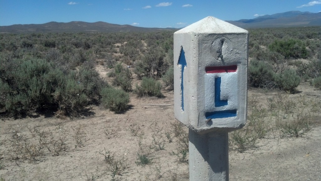
A Lincoln Highway marker stands alongside the Loneliest Road in America. (Photo by Michael E. Grass)

A historic Lincoln Highway marker stands alongside the Loneliest Road in America. (Photo by Michael E. Grass)

FALLON, Nev. — In my trek westward toward San Francisco on the Lincoln Highway, my earlier travels across the grand emptiness of the Great Plains may have spoiled the so-called “Loneliest Road in America.”

Along U.S. 50, the so-called "Lonliest Road in America," near Austin, Nev. (Photo by Michael E. Grass)

Along U.S. 50, the so-called “Lonliest Road in America,” near Austin, Nev. (Photo by Michael E. Grass)

Sure, the distances between towns on U.S. 50 in Nevada can be quite far, but I was never truly alone out in the middle of nowhere like I had been, for instance, for most of U.S. 30 near the Medicine Bow Mountains in Wyoming, a stunningly beautiful place that made me feel blissfully alone under the endless mountain-framed skies.

On the Loneliest Road in America — that description for this stretch of U.S. 50 came from a 1980s Life magazine feature and is now used for regional marketing — I encountered a car or truck every few miles — sometimes even more often than that. At historic markers and other points of interest, there had been other tourists, including those seeking to get souvenir Loneliest Road travel passports stamped along the way.

When it comes to central Nevada, Lincoln Highway enthusiasts often talk about the older, more desolate alignments that roughly parallel and intersect the modern road along the way. Those who are more adventuresome might want to attempt those rougher alternative routes less traveled. While those roads may be more historically accurate, adhering to the original 1913 Proclamation Route, I didn’t want to test the limits of my rental car out in the desert.

The vastness out here hasn’t made such as big an impression as I thought it would. Yes, this territory has a rough beauty, but it’s not stunningly beautifully. But that’s not why I came out all this way.

Continue reading

The Lurking Legacy of Nevada’s Lead Boom

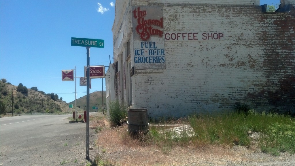
At the corner of Treasure and Main streets in Eureka, Nev. (Photo by Michael E. Grass)

At the corner of Treasure and Main streets in Eureka, Nev. (Photo by Michael E. Grass)

2013-06-20 12.24.24EUREKA, Nev. — This place might be the best example of an old mining town anywhere along the Lincoln Highway.

Heading into town along Main Street, the names of the crossstreets are inspired by mining — Gold, Silver, Treasure, Bullion and Mineral streets.

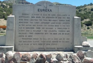
A historic marker on the way into town succinctly describes Eureka’s boom and bust. Naturally, a miner yelled “Eureka!” when a rich vein of silver-lead ore was discovered here in 1864 and that’s how this place got its name. (In ancient Greek, “Eureka” means “I’ve found it,” a saying that’s been attributed to Archimedes.)

Back in the days of plenty, Eureka had plenty of smelters — 16, to be exact. And saloons, too. One-hundred of them.

As Pete Davies noted in American Road, Eureka was once home to 9,000 people and with an abundance of smelting, it was called the Pittsburgh of the West, “with toxic air to match.”

By the early 1890s, Eureka’s glory days were waning. But the legacy of that late 19th century prosperity remains, with hints of the good, the bad and the dangerous.

Continue reading

Observing America From the La Quinta Inn Breakfast Room

ELY, Nev. — Maude Flanders was not pleased. The plain-looking woman who was sitting two tables over from me in the breakfast room of the La Quinta Inn reminded me of Ned Flanders’ wife from The Simpsons. So as a breakfast activity, I named her Maude.

Maude, who looked like she recently became eligible for AARP discounts, was finishing the remainder of whatever up-and-at-em morning liquid was inside the diminutive disposable cup positioned next to her half-eaten muffin. Was it coffee or orange juice? I couldn’t tell. It didn’t really matter because more importantly Maude was irked.

The stocky mustachioed man sitting next to her — I assumed that was her husband — looked like one of Bill Swerkski’s Chicago Superfans from the classic 1990s-era “Saturday Night Live” skit. He had just used his finger to spoon up the last of the grayish-white country gravy from his now-devoured biscuits. He seemed quite satisfied as he sucked his index finger clean and finished breakfast with a clean plate.

But the finger sucking by Maude’s gravy-loving companion didn’t seem to bother her. I don’t think she even noticed since something on the flat-screen television across the way had captured her undivided attention.

Post continues below …


CNN’s Carol Costello had just introduced one of Jeanne Moos‘ quirky human interest features. This one featured “prancersice.” (Watch the video above to see glorious oddity.)

By the time Moos had found a reason to resurrect and recycle Joanna Rohrback’s strange exercise routine for CNN’s infotainment purposes, prancercise was weeks-old news. It had gone viral back in May. As Maude stared at the television in the neutral-toned breakfast room off the lobby, it was now June 20.

“We live in such a weird country but I love it,” Costello expressively declared as she wrapped up the segment, according to CNN’s transcript.

Maude shook her head in a most decidedly sour manner. But I doubt that she was reacting to CNN’s lame attempt to extend the shelf life of the stupid and stale prancercise story. Perhaps it was Maude’s way of lamenting the current state of CNN or the cable news industry as a whole. Did Maude find Carol Costello particularly abrasive to the ears and eyes? Maybe Maude was completely sheltered and prancercise was just too much to handle. Or perhaps Maude just saw a little of herself in the quirky prancercise lady. They did share a strange resemblance to one another.

Like Joanna Rohrback, Maude Flanders was wearing a similarly citrusy-colored top — in this case, a pink-lemonade-colored sleeveless golf polo — white pants and white tennis shoes. Their hairstyles were both big and wavy. But I got the sense that Maude would be horrified to see herself on YouTube flailing her arms and prancercising her way through a local park. Maude was a wonderful mystery best observed from a few tables away and not to be disturbed in this mundane setting.

As I pressed west along the Lincoln Highway, I never knew quite who, or what, to expect in the hotel breakfast room morning after morning. It was always a surprise. Prancercised-shocked Maude was an absolute gem, but there were other random hotel guests along my trip who were just as delightful to observe. I found the breakfast room at the La Quinta Inn — or Holiday Inn Express or Courtyard by Marriott — always a strange spectacle even if nothing truly notable happened.

But there were also bizarre and peculiar moments.

Continue reading

‘Justice Was Meted Out by the Vigilante Committee and the Hanging Rope’

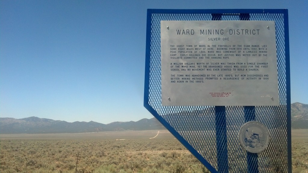
A historic marker near the ghost town of Ward, Nev., notes how the "vigilante committee and the hanging rope" helped keep the peace. (Photo by Michael E. Grass)

A historic marker near the ghost town of Ward, Nev., notes how the “vigilante committee and the hanging rope” helped keep the peace. (Photo by Michael E. Grass)

WARD, Nev. — In Travels With Charley, John Steinbeck wrote that “those states with the shortest histories and the least world-shaking events have the most historical markers. Some Western states even find glory in half-forgotten murders and bank robberies.”

For such an empty place, Nevada is full of historic markers. Many of the ones I encountered in the central part of the state  — and I suspect elsewhere, too — celebrate the state’s rich mining heritage. The sign marking the ghost town of Osceola, northwest of Mount Wheeler in Great Basin National Park, notes how the nearby mining operations there once produced a gold nugget valued at $6,000. (I’m assuming that was a big deal at the time but nothing like the Comstock Lode.)

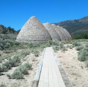
The abandoned charcoal ovens at Ward, Nev., are open to the public. (Photo by Michael E. Grass)

The abandoned charcoal ovens at Ward, Nev., are open to the public. (Photo by Michael E. Grass)

Closer to Ely, a marker off U.S. 93 celebrates the mining heritage of the ghost town of Ward, a place which was “booming from 1876 until 1882” before it was abandoned. Ward was a lawless place and from its description sounded like the type of settlement that could have inspired a John Wayne movie.

“Early killings did occur, but justice was meted out by the vigilante committee and the hanging rope,” according to the marker.

For the most part, there’s nothing left of these ghost towns. In the case of Ward, the roadside marker was miles from the actual site of the town, off-limits on the property of the modern-day mining operation. But Ward’s beehive-shaped charcoal ovens beehive-shaped charcoal ovens are certainly worth checking out.

Continue reading

‘Give Me Solitude’ Among the Ancient ‘Grotesque’ Trees

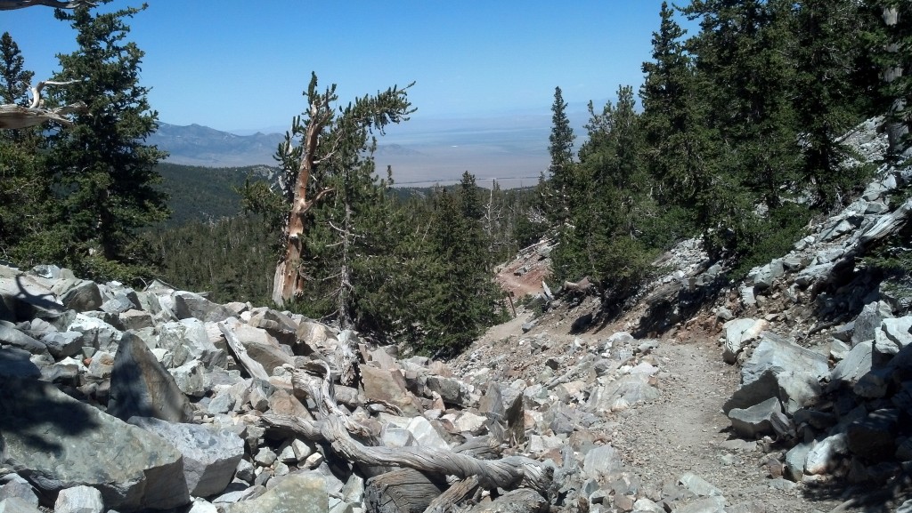
The Bristlecone Pine Trail on Mount Wheeler in Great Basin National Park (Photo by Michael E. Grass)

The Bristlecone Pine Trail on Mount Wheeler in Great Basin National Park (Photo by Michael E. Grass)

BAKER, Nev. — As I’ve been traveling along the Lincoln Highway from the East Coast toward the Pacific, there have been few moments where I’ve felt truly alone.

Yes, I’ve been traveling mostly solo, but with my smartphone — and with it, Facebook, Twitter, text messages and email — the normal life I would ordinarily be living back in Washington, D.C., has been within easy reach even as I’ve been thousands of miles away. For better or worse, that’s the world we live in today.

When I set out for Great Basin National Park, about 62 miles from Ely, I entered truly unconnected territory. There was no cellphone reception.

I had a momentary panic attack. Not a real one of course, but I was slightly uneasy as I drove deeper and deeper into the desert. I scanned for local radio stations. It was the first time I’ve ever pressed “Scan” on a car radio and it turned up absolutely nothing.

In his poem “Give Me the Splendid Silent Sun” from Drum Taps, Walt Whitman wrote “Give me solitude — give me Nature — give me again O Nature your, primal sanities!”

If I had some sort of time machine, I would have loved to have dragged Whitman up toward the top of Mount Wheeler to sit among the bristlecone pine trees that are older than the Egyptian pyramids.

Continue reading

Bright Neon and Faded Dreams on the ‘Loneliest Highway in America’

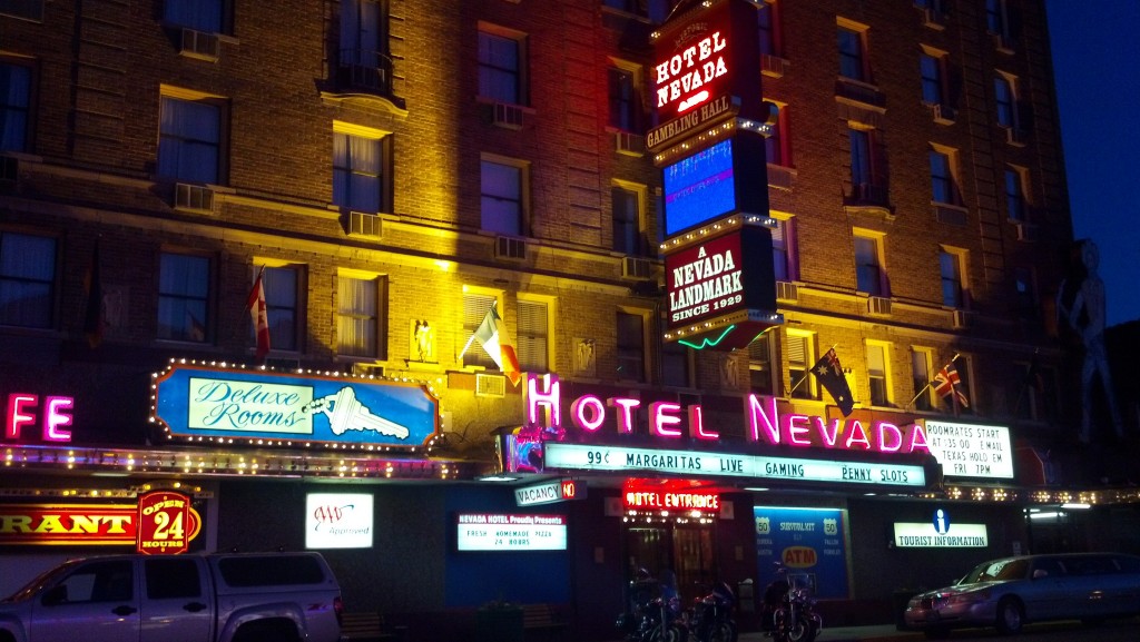
The Hotel Nevada is the flashiest place in Ely, Nev. (Photo by Michael E. Grass)

The Hotel Nevada is the flashiest place in Ely, Nev. (Photo by Michael E. Grass)

ELY, Nev. — It’s hard to miss the Hotel Nevada. It has bright, colorful lights, neon and if I’m not mistaken it’s the biggest place in town. It was the tallest building in the entire state when it opened in 1929.

Ely is a former mining town along the Central Overland Route, the mail delivery trail between Salt Lake City and San Francisco first used in 1858. This path across central Nevada, which was later followed by the Pony Express, can trace its origins to a man looking to win a bet.

According to The Overland MailLeRoy R. Hafen’s 1926 authoritative history of mail delivery in the American West:

[A] Utah pioneer, Howard Egan, had explored a direct route from northern California to Salt Lake City which followed very nearly the fortieth parallel, north latitude. In September, 1855, he retraced his steps and won a wager by riding a mule back from Salt Lake City to Sacramento in ten days.

Later, the Central Pacific Railroad, part of the first transcontinental rail link between California and the East, bypassed this route for one through northern Nevada along the Humboldt River.

When the Lincoln Highway came through Nevada, it followed the old Central Overland Route, bringing crosscountry travelers right through Ely. But when the Interstate Highway System was planned, I-80 tracked north along the Humboldt River, leaving Ely isolated on the so-called “Loneliest Highway in America.”

Every town out this way is an oasis since the distance to the next sizable human settlement along the road can be as many as 168 miles away. In this isolation, such a showy establishment like the Hotel Nevada certainly stands out. But for all the glitz and glam in the center of town, the rest of Ely felt like a very lonely place when I drove into town. Continue reading