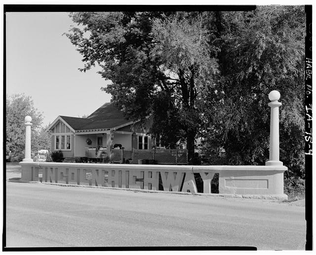
The Lincoln Highway Bridge in Tama, Iowa, taken sometime after 1968. (Historic American Engineering Record photo via Library of Congress >>)
TAMA, Iowa — For Lincoln Highway enthusiasts, a stop in this small town about an hour west of Cedar Rapids is mandatory. On its eastern approach into the town from the U.S. 30 expressway bypass — and just off an older local bypass — the Lincoln Highway travels over a short bridge spanning a small creek.
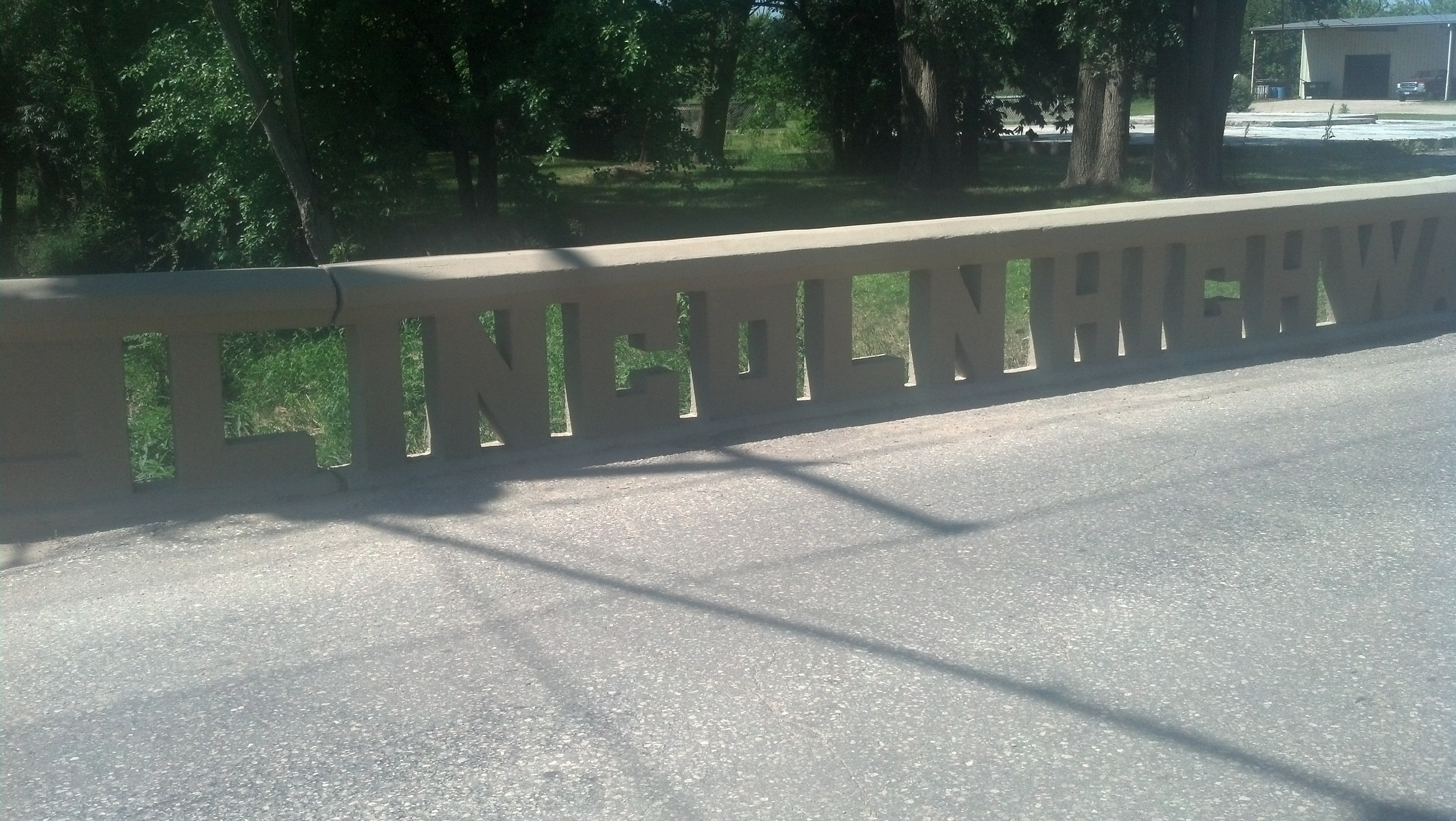
The famous Lincoln Highway Bridge in Tama, Iowa (Photo by Michael E. Grass)
The concrete railing spells out “LINCOLN HIGHWAY.” It was a way for little Tama to stand apart from other towns proud to have the highway’s alignment go through their town. (Tama, in fact, hosts an annual Lincoln Highway Bridge Festival.)
By simply spelling two words out in concrete, this tiny town transformed the Lincoln Highway into its own modern monument. To the rest of the state, it showed that Tama wasn’t stuck in the mud.
Iowa’s often impassable dirt roads were notoriously bad. And there were disagreements on how to improve them or whether to improve them at all.