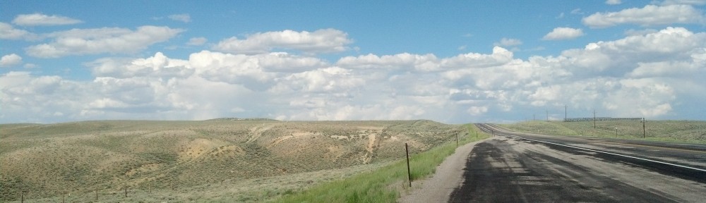
Heading westward toward sunset, somewhere along Interstate 80 in southern Wyoming (Photo by Michael E. Grass)
EVANSTON, Wyo. — Traveling across Wyoming’s southern tier, I had one destination in mind: a hotel bed. Originally, my plan was to drive all the way from my mid-trip relaxation stop at Boulder, Colo., to Salt Lake City, but when a friend in Colorado asked me whether I knew “that’s a really, really long way” to do solo, I decided to reassess my options. I did, after all, want to make a few stops along the way and take the longer, more scenic drive along the Lincoln Highway’s original route via Medicine Bow.
I decided that Evanston, a city established when the Union Pacific Railroad pressed west through this part of Wyoming in the late 1860s, would be a good stopping-off point. It would still necessitate a long driving day because there is no such thing as a quick trip anywhere in Wyoming.
Like many towns along the transcontinental railroad, Evanston once had a sizable Chinese population in its early years. In fact, there have been archaeological excavations of Evanston’s former Chinatown which uncovered materials belonging to Chinese women, who were always a rarity in these male-dominated communities along the railroad.
According to Western Wyoming Community College:
The most distinctive pieces of jewelry recovered during excavations that can be attributed to women are earrings. Photographs of Chinese women in Evanston show women wearing earrings similar to the ones uncovered in excavation. Other jewelry items uncovered in excavation are less useable as indicators of gender. However, the earrings recovered, as well as the other jewelry items uncovered, come from one living space that posses an internal courtyard. Based on the gold, silver, Ming Dynasty ceramics, jade fragments, variety and number of coins recovered, and shear quantity of artifacts found in this one area, we contend that the occupants had a relatively high economic status–especially when compared to the Chinese coal miner’s quarters north of Evanston at Almy and even railroad laborers homes inside the Evanston Chinatown.
The history of Chinese laborers building the transcontinental railroad and the industries they served along the route is a decidedly unhappy one, especially in Wyoming.
Post continues below …
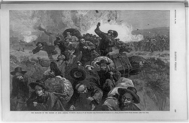
An illustration from Harper’s Weekly of the 1885 massacre at Rock Springs, Wyo. (Engraving by Thure de Thulstrup courtesy the Library of Congress Prints and Photographic Division >>)
No town wants to be associated with the word “massacre” but for Rock Springs, the brutal anti-Chinese violence that played out here in September 1885 is inescapable.
This is where a mob of white coal miners, primarily from the British isles and Scandinavia, targeted and viciously attacked their Chinese counterparts in an ongoing dispute over low pay. Just as the white miners were protesting poor working conditions and low pay, the Chinese workers were willing to work under those terrible conditions for even less.
The white mob, including local women and children, surrounded Chinatown, torched its ramshackle buildings and killed 28 Chinese workers in the process.
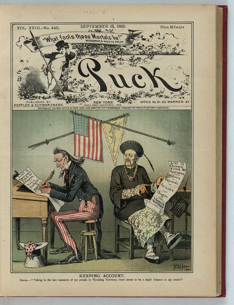
This cover illustration from the Sept. 16, 1885, edition of Puck magazine depicts Uncle Sam and a Chinese map preparing lists of where Chinese had been killed in the United States. (Courtesy the Library of Congress Prints and Photographs Division >>)
As author Tom Rea detailed in his excellent but gruesome history of the massacre posted at WyoHistory.org:
Rock Springs’ Chinatown was gone. Even more horrifying, there still were bodies in what had been Chinatown’s streets. Not that many—perhaps a dozen; two dozen at the most. Some had been buried by the coal company, but these had not. Many were in pieces. These were bodies of their friends, sons, fathers, brothers and cousins, murdered by a mob of white coal miners.
“[M]angled and decomposed,” the Chinese miners reported later to a Chinese diplomat in New York, the bodies “were being eaten by dogs and hogs.”
And now the coal company, owned by the Union Pacific Railroad, expected the miners to bury their dead, put the memories of this abomination behind them and go back to work. Until new houses could be built, they would be living in the boxcars.
Sixteen white miners were arrested but charges were never filed. Federal troops came in to keep the peace.
Because of its history, I was naturally drawn to Rock Springs. But when I drove through town in my rental car with Virginia plates, I felt like should have bypassed it on I-80.
Some small towns will gladly welcome out-of-town travelers, especially those who venture away from the cookie-cutter franchises close to the interstate highway and into the true heart of their communities. Small-town hospitality can be legendary. But I instantly sensed that Rock Springs was a place that was suspicious of outsiders, at least from the limited interactions I had with the locals.
While stopped at a traffic light, a man in a pick-up truck wearing a tan cowboy hat and white T-shirt gave me a somewhat evil eye while flaring his nostrils. It wasn’t quite a scowl, but it was it was enough to know that if I wanted to ask him about the 1885 massacre, he probably wouldn’t have been too pleased.
At a gas station, I bought some Jack Link’s beef jerky, my favorite roadtrip snack. A gloriously plain-looking woman behind the counter barely muttered anything to me as she gave me my change. She did, however, grunt “Here!” as she pushed the handful of pennies and dimes my way. I checked to make sure my fly wasn’t down that something wasn’t wrong with my appearance. I thought I looked fairly normal. I could have been mistaken for a local, I thought. Perhaps I should have said “Howdy” instead of “Hello.”
Later, a police cruiser closely followed me from Broadway in the central business district out to Dewar Drive, the main drag that leads back to I-80. The officer was seemingly waiting for me to violate some minor traffic law. (Fortunately, I did not.)
With my unwanted police escort, I decided that it would be best for me to move on. Were my Virginia license plates some sort of scarlet letter? Was I a Hester Prynne without the adultery? Perhaps my gut feeling about this place was wrong, but a first impression can make or break any visit. And my impression of this place was not good. Perhaps Rock Springs has some unsettled history from its terrible 1885 massacre that it still needs to come to terms with.
William Faulkner once wrote that “[t]he past is never dead. It’s not even past.” Maybe that applies to Rock Springs. But I sincerely hope for the sake of the Rock Springs Chamber of Commerce that what I encountered was not the norm for the town.
***
To reach Evanston, I needed to cross the empty expanse of the Great Divide Basin, a topographical peculiarity of the Rocky Mountains. This 3,900 square-mile area is a place caught between two branches of the Continental Divide where the water that enters has no outlet to the sea.
According to the Wyoming State Geological Survey:
Travelers on Interstate 80 between Rawlins and Rock Springs may not realize it, but they will have crossed the Continental Divide twice and driven through the southern part of the Great Divide Basin. The first crossing is approximately 5.5 miles west of Rawlins near the Hadsell exit; the second crossing is between the Red Desert and Table Rock exits, approximately 58 miles west of Rawlins. Because of the red- and purple-colored rocks and soil in the area, this basin is often called the Red Desert.
At the northern end of the Great Basin Divide is South Pass and beyond it is the Green River, which eventually drains into the Colorado River. I had hoped that the Lincoln Highway’s route would have actually traveled through South Pass, but I was roughly 60 miles south and out of luck.
Post continues below …
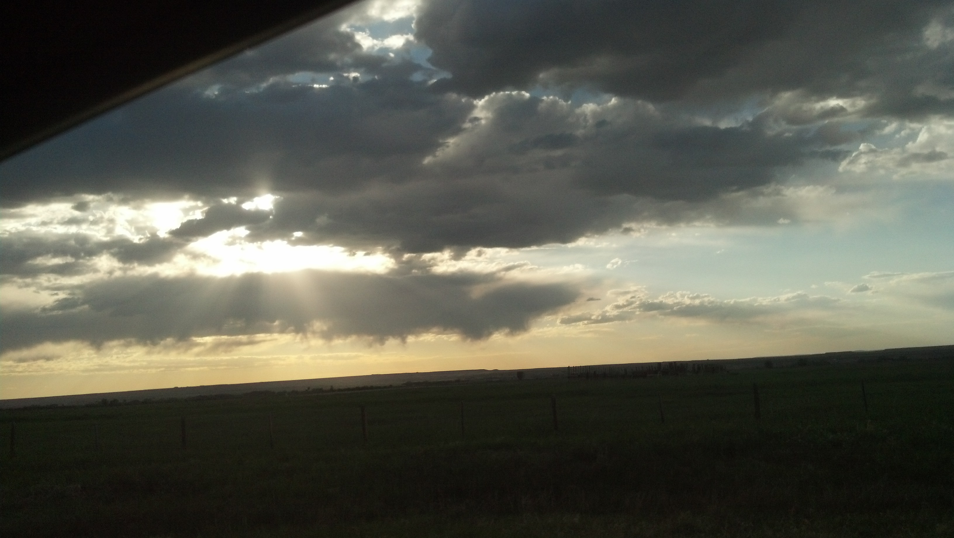
Yep, it’s still pretty flat out here. (Photo by Michael E. Grass)
Like California Hill in western Nebraska, South Pass is a historically important spot associated with westward migration. This is where many notable trails, like the Oregon Trail, crossed the Continental Divide because the terrain was gentle. Without this “isolated little saddle that straddles the Continental Divide in the midst of Wyoming,” the course of westward expansion would have taken very a different route west, according to author Will Bagley.

A section of the detailed map made as part of John C. Fremont’s western expeditions. Below the Wind River Mountains, you’ll see South Pass. (Courtesy the Library of Congress >>)
But it’s a fairly unassuming crossing. As John C. Fremont noted in his 1842 expedition:
The face of this country cannot with propriety be called hilly. It is a succession of long ridges, made by the numerous streams which come down from the neighboring mountain range. The ridges have an undulating surface, which some such appearance as the ocean presents in an ordinary breeze. …
From the mouth of the Kansas to the Green river valley, west of the Rocky mountains, there is no such thing as a mountain road on the line of communication.
The transcontinental railroad and later the Lincoln Highway and Interstate 80, skipped South Pass for a shorter route across southern Wyoming. But the lack of mountains in this part of the Rocky Mountains might be a surprise to the traveler expecting cragged topography that’s more like Colorado.
It was in this general vicinity where Fremont’s 1842 expedition encountered Native Americans who had nearly starved to death after swarms of grasshoppers had stripped the landscape of all vegetation, driving buffalo and any other animal worth hunting out of this barren territory.
Fremont and his men had 10 days of provisions but would need to hunt game in the near future to stay fed. “We’ll eat the mules,” said one of Fremont’s men, Basil Lajeunesse. They pressed onward.
I’m not sure what I would have done if the tables were turned. The interior of my rental car did not seem all that appetizing and for sure lacked nutrition.
Fortunately, I had plenty of gas and scraps of beef jerky to make it to Evanston. I checked into a Holiday Inn Express near I-80 and ventured into the central business district to hunt down a late dinner. I found Suds Brothers Brewery on Main Street to be mostly empty.
My twentysomething waitress greeted me with a beaming grin: “Hey there, welcome. Can I start you out with a drink?”
I’m glad I stopped here instead of Rock Springs.